Reflecting on our participatory food systems mapping workshop at the 16th International Conference on Food Studies in Osaka, this article introduces the approach, shares insights from its implementation, and offers practical guidance for anyone interested in adapting or replicating the activity in their own research or workshops.
Food systems are complex, interconnected socio-ecological systems shaped by relationships between people, institutions, landscapes, cultures, and natural resources. Yet, when discussing food systems, it is easy to focus on individual components—such as agricultural production, distribution, or consumption—without considering how they interact or how different people understand these relationships.
Collaborative mapping offers a way to make these connections visible. By bringing participants together to draw, discuss, and rethink food systems, researchers can create opportunities for shared learning, collective reflection, and the exchange of different forms of knowledge.
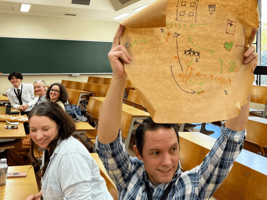
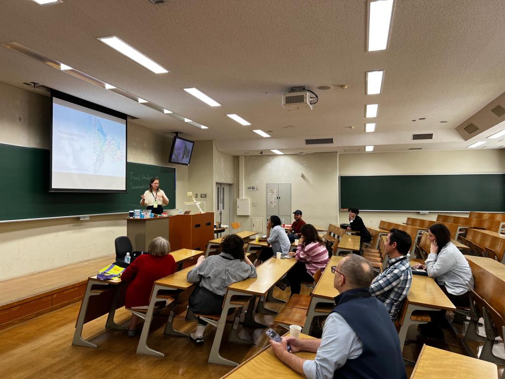
At the 16th International Conference on Food Studies at the University of Osaka, we designed and facilitated an interactive workshop exploring food systems through the conference theme, “Living with Water: Food and Life.” The activity used a three-stage participatory mapping process: silent system design, collective reflection, and collaborative redesign.
This article outlines how to organize and facilitate the exercise, including practical instructions, suggested questions, and reflections from its implementation. The format can be adapted for academic conferences, interdisciplinary research workshops, community engagement, and participatory action research.
Understanding the Approach
Participatory mapping is a visual and collaborative research method that allows participants to represent their understanding of a particular system, environment, or issue. Rather than relying exclusively on written responses or verbal discussion, participants use drawings, keywords, symbols, and spatial relationships to communicate ideas.
In food systems research, mapping can help reveal how people understand relationships between food production, distribution, consumption, and the broader social and ecological environments in which these activities take place.
However, collaborative exercises can sometimes privilege participants who are more comfortable speaking, debating, or expressing their ideas verbally. To address this, our workshop introduced an initial silent mapping exercise before opening the floor to discussion.
The intention was to give participants time to independently externalize their understanding of food systems before negotiating a shared representation with others.
The process was designed around three stages:
- Silent system design: Participants independently contribute ideas to a shared map without speaking.
- Collective reflection: Groups present their maps and discuss the elements they prioritized, overlooked, or represented differently.
- Collaborative redesign: Participants revisit their maps through open discussion, incorporating new perspectives and reconsidering their initial assumptions.
The comparison between the initial and revised maps provides a starting point for examining how dialogue influences collective understandings of complex systems.
Preparing the Workshop
Format: 45-minute interactive workshop
Ideal participants: 5–15 people
Group size: 2–3 small groups
Facilitation: Ideally, one facilitator, with an additional person documenting the process if possible.
The exercise requires relatively few materials and can be implemented in different settings.
Materials:
- Large sheets of paper (flip-chart paper or poster paper)
- Colored markers and pens
- Sticky notes in different colors
- Optional: colored paper, stickers, or other collage materials
- A timer
- A camera or phone to document the maps (with participant consent)
Sticky notes are particularly useful because they allow participants to move, reorganize, and connect ideas without having to redraw the entire map.
Before beginning, arrange participants into two or three groups. If possible, encourage a mix of disciplinary backgrounds, professional experiences, and geographical perspectives. This diversity can enrich the exercise by bringing different understandings of food systems into the same discussion.
Facilitating the Activity: A Step-by-Step Guide
Step 1: Introduction and Framing (5 Minutes)
Begin by briefly introducing the purpose of the exercise. Explain that the objective is not to produce a technically accurate or comprehensive representation of a food system, but to explore how people understand its components and relationships.
Connect the activity to the workshop’s overarching theme. In our case, “Living with Water” provided an entry point for considering the relationships between food systems and their surrounding socio-ecological environments.
Divide participants into small groups and provide each group with paper and drawing materials.
Suggested introduction:
“Food systems involve many interconnected actors, processes, and relationships. Today, we are going to explore how we understand these systems by creating visual maps together. There are no right or wrong answers. We are interested in what you consider important, what connections you make, and how your perspectives might change through discussion.”
Step 2: Silent System Design (10-15 Minutes)
Ask each group to design and draw a food system without speaking.
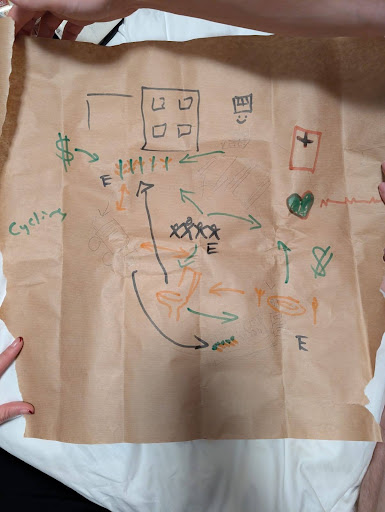
Participants should work together on a single map, but communicate exclusively through drawing, writing, or adding sticky notes. They can build on one another’s contributions, add new elements, or create connections between different components.
The silence is intentional. Without verbal negotiation, participants must communicate their ideas visually, making their initial priorities and assumptions more visible.
Encourage participants to consider different dimensions of a food system, including:
- Food production and agricultural practices
- Processing, transportation, and distribution
- Retail, markets, and consumption
- Farmers, consumers, businesses, and institutions
- Cultural practices, traditions, and food identities
- Natural resources, ecosystems, and environmental conditions
- Water, land, biodiversity, and climate
Avoid providing too many examples at the outset, as this could influence what participants choose to include.
Facilitator tip: Allow participants to interpret the task in their own way. Some may prefer drawing interconnected systems, while others may use keywords, arrows, or sticky notes. The different approaches are part of the exercise.
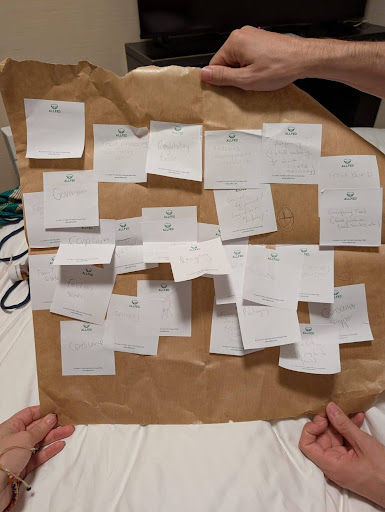
Step 3: Rapid Presentations and Guided Reflection (10 Minutes)
Once the initial maps are complete, invite each group to briefly present its work.
Ask participants to explain what they included, what they prioritized, and how they approached the mapping process. Encourage them to reflect on both the content of their maps and the experience of working silently.
For our workshop, we used three guiding questions:
- What is important in a food system?
- What does a sustainable food system look like?
- What role does water play in your local food system?
The third question connected the activity to the conference theme, encouraging participants to consider whether water was explicitly represented in their initial understanding of food systems.
Additional prompts can help deepen the discussion:
- Which actors or relationships did you prioritize?
- Were there aspects of the food system that you found difficult to represent?
- What perspectives or dimensions might be missing?
- Did everyone in the group approach the task in the same way?
The purpose is not to evaluate the maps, but to identify differences in how participants conceptualize food systems before moving into the collaborative redesign.
Step 4: Collaborative Redesign (10-15 Minutes)
Now invite groups to revisit their original maps and redesign them through open discussion.
Participants can add overlooked elements, introduce new connections, reconsider existing relationships, or start again if they feel their initial representation no longer captures their collective understanding.
Encourage participants to think beyond the more visible and logistical components of food systems. For example, they might consider cultural identities, social inequalities, power relationships, ecological processes, or the influence of local environments.
For a workshop focused on water, participants might explore how water connects agricultural production, food security, livelihoods, ecosystems, and everyday consumption.
The objective is not necessarily to produce a more comprehensive map. Instead, the redesign provides an opportunity to explore how different perspectives are negotiated and incorporated into a shared representation.
Facilitator tip: Give participants a clear time limit. Open discussion can quickly become absorbing, and groups may spend more time debating how to represent ideas than actually mapping them. Remind them that the map is a tool for thinking, not a finished product.
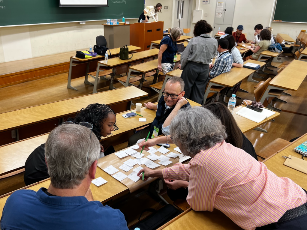
Step 5: Comparative Reflection (10 Minutes)
Bring the groups together to compare their initial and revised maps.
This is an important stage of the exercise. Ask participants to consider what changed, what remained, and how the process of discussing different perspectives influenced their thinking.
Suggested questions include:
- What changed between your first and second maps?
- Were there ideas or perspectives that you had initially overlooked?
- Did the group agree on what should be included?
- Were there disagreements about how certain relationships should be represented?
- Did discussion change how you understand the relationship between food systems and water?
- What was easier or more difficult about working collaboratively?
Encourage participants to reflect on the process itself, rather than focusing exclusively on the final visual output.
The comparison can reveal how individual assumptions, disciplinary perspectives, and collective negotiation shape the way complex systems are understood.
Step 6: Closing Takeaways (5 Minutes)
Conclude with a brief collective synthesis.
Invite participants to share one insight they gained from the exercise or one aspect of food systems they would now approach differently.
Summarize recurring themes, differences in perspective, and any questions that emerged during the activity.
If the maps are being used for research purposes, explain how the visual materials and accompanying reflections may be documented and analyzed, in accordance with the consent arrangements established beforehand.
What We Learned
Our workshop demonstrated that the transition from silent mapping to open collaboration can produce interesting differences in how participants approach a shared task.
Initially, some participants appeared hesitant about the silent format. However, they quickly began contributing ideas and developed creative ways of representing food systems. Some participants used drawings, while others preferred sticky notes to record individual components and relationships.
During the first round of presentations, participants reflected on the difficulty of working together without speaking. Although it was sometimes challenging to understand or build on another person’s ideas, the visual contributions provided a starting point for others to respond and develop new connections.
The presentations also revealed differences in how groups conceptualized food systems. One group, for example, recognized that its initial map had taken a largely logistical approach, focusing on the movement and organization of food while giving less consideration to cultural dimensions.
The collaborative redesign introduced a different set of challenges. Although participants now had the opportunity to discuss their ideas openly, they found it more difficult to reach a shared representation. Some groups chose to build on their original maps, adding new elements and relationships, while others decided to start from scratch.
Interestingly, participants appeared to accomplish less in terms of producing a finished map during this second stage. More time was spent discussing suggestions, negotiating different perspectives, and deciding how to represent everyone’s contributions.
This highlighted an important distinction between individual contribution and collective agreement. While silent mapping encouraged participants to externalize ideas relatively quickly, open discussion introduced the complexities of representing multiple perspectives within a shared framework.
Rather than viewing this as a limitation, it offers an important insight into collaborative research methods: the process of negotiating a shared understanding can be just as valuable as the visual output itself.
The exercise also highlighted the importance of leaving sufficient time for reflection. The differences between the initial and revised maps provided a tangible way for participants to consider how their thinking had evolved, which perspectives had been introduced, and which dimensions remained underrepresented.
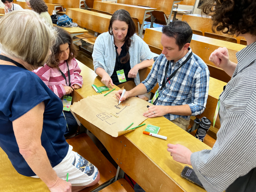
Documenting and Analyzing the Results
Beyond facilitating discussion, participatory mapping can generate visual and textual materials that researchers may use for further analysis.
If the exercise is intended to contribute to a research project, consider documenting both the maps and the conversations surrounding them.
Potential materials include:
- Photographs of the initial and revised maps.
- Written notes and keywords added by participants.
- Facilitator observations about group interactions.
- Notes from group presentations and collective reflections.
- Short participant reflections at the end of the activity.
These materials can be examined using qualitative thematic analysis.
For example, researchers might identify recurring themes across maps, such as the role of institutions, the importance of local knowledge, the visibility of cultural practices, or the relationship between ecological processes and food production.
A comparative analysis of the initial and revised maps could also explore:
- Which actors or relationships were added, removed, or repositioned?
- Did participants introduce new ecological or social dimensions?
- How were cultural values and local knowledge represented?
- Did discussions reveal tensions or disagreements?
- Were some perspectives more difficult to incorporate into the shared map?
Importantly, the absence of an element from a map should not automatically be interpreted as evidence that participants consider it unimportant. It may reflect the time constraints, group dynamics, or difficulty of representing certain relationships visually. The accompanying discussion and participant reflections are therefore essential for interpreting the maps.
Researchers should also establish informed consent and clarify how maps, photographs, and participant contributions will be stored, shared, and potentially published.
Adapting the Exercise to Different Research Contexts
Although our workshop was designed around the theme of “Living with Water,” the three-stage mapping process can be adapted to a variety of research questions and settings.
For example:
- Urban food systems: Explore relationships between food production, markets, food access, transportation, and consumption in a particular city.
- Climate change and agriculture: Examine how farmers, institutions, ecosystems, and local communities interact in responding to environmental change.
- Food culture and identity: Explore how traditions, migration, cultural practices, and intergenerational knowledge shape food systems.
- Agroecological transitions: Map the relationships between farmers, researchers, extension services, markets, and ecological processes.
- Water and food security: Investigate how water availability, management, and governance influence food production and livelihoods.
The exercise can also be adjusted for different participant numbers. With larger groups, facilitators can create additional mapping teams and allocate more time for presentations, or invite participants to rotate between maps and contribute to one another’s work.
The guiding principle is to retain the three stages: first making individual assumptions visible, then creating opportunities for dialogue, and finally reflecting on how collective interaction shapes the resulting representation.
Conclusion
Collaborative mapping provides a practical way to explore the complexity of food systems while creating opportunities for interdisciplinary exchange and collective reflection.
Our experience at the 16th Annual Food Studies conference demonstrated that moving from silent contributions to open discussion can reveal both the possibilities and challenges of collaborative knowledge creation. The initial maps offered a glimpse into how participants independently understood food systems, while the redesign process exposed the negotiation involved in bringing different perspectives together.
Importantly, the value of the exercise did not lie in producing a single, definitive representation of a food system. Rather, it lay in making different understandings visible and creating space to question how knowledge, assumptions, and values shape the ways we conceptualize interconnected socio-ecological systems.
For academics interested in participatory action research, collaborative mapping offers an accessible and adaptable method for bringing diverse perspectives into conversation—and for exploring not only how we understand complex systems, but how those understandings might change through collective learning.
Photos courtesy of Morgane
Morgane Bataki
Morgane is co-founder of The Foodscapes Collective and a recent PhD graduate in Environmental Sciences at the Open University of the Netherlands. She holds a BA in Cultural Studies and an MA in Food Politics. While her research focuses specifically on transformations towards sustainable agriculture, she is equally passionate about all things food-related, especially exploring the world through diverse cuisines.
Want more content like this? Subscribe to The Foodscapes Collective to be the first to know about articles like this and more.




Leave a Reply